Find a Big Island Hawaii map below
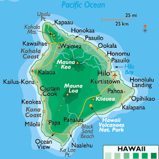
The Island of Hawaii, also known as "The Big Island", is the largest island in the Hawaiian archipelago. In fact, not only is it the largest but it is larger than all of the other islands put together. Its total land mass is 4,028 square miles (10,430 km2). The island`s political entity is the county of Hawaii, which exists within the state of Hawaii.
At its widest point, the island is 93 miles or 150 kilometers wide. The very tall volcanic mountain called Mauna Kea is located in Big Island Hawaii map. The island is actually comprised of 5 shield volcanoes that erupted in sequence and build on top of each other.
Find useful Big Island Hawaii map files below:


I hope you found a great Big Island map up above! Have a look at the other Hawaii maps in case you need maps of the other islands.


0 Comments