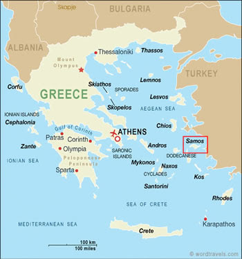
The Agean Sea is a subdivision of the Mediterranean Sea, specifically an embayment that extends northward between Greece and Turkey. The Aegean Sea connects to the Sea of Marmara by way of the Dardanelles and the Black Sea by way of the Bosporus Strait. The Aegean Islands are located within the Aegean Sea, including the major islands on its southern periphery, including Rhodes and Crete.
The area of the Aegean Sea covers 214,000 square km - or 83,000 square miles. It is approximately 610 km long from north to south (380 miles), and about 300 km (or 190 miles) from east to west.
Here are some Aegean Sea map files for you to download or print out.
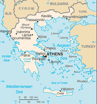

The area of the Aegean Sea covers 214,000 square km - or 83,000 square miles. It is approximately 610 km long from north to south (380 miles), and about 300 km (or 190 miles) from east to west.
Here are some Aegean Sea map files for you to download or print out.


0 Comments